Earth Science and Engineering
Seismic echo turns into super-resolution images
A signal processing technique that makes use of seismic echoes is able to image subsurface geology at unprecedented resolution.


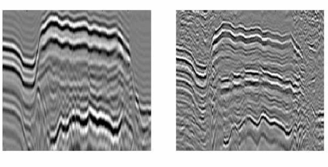
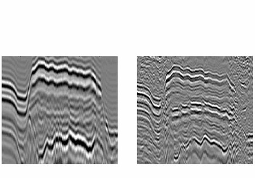
Super-resolution seismic imaging using resonant multiples significantly enhances the resolution of seismic images, providing a more accurate method for oil and gas exploration.
Reproduced from reference 1 under creative commons licence © 2016 KAUST
By analyzing echoes previously discarded as noise in seismic data, KAUST researchers have found a way to more than double the spatial resolution of subsurface seismic imaging1. The advance could improve the characterization of subsurface geology, with major implications for oil and gas exploration and seafloor research and engineering.
Seismic imaging is a relatively quick way to estimate the structure and general properties of the ground at depth without drilling. The technique involves firing a pulse of vibration into the ground and then detecting the vibrations that return as the pulse bounces off boundaries between different types of rocks, liquids or voids. The time taken for the pulse to return is used to calculate the depth to each feature, resulting in a two-dimensional image of subsurface structure.
Although this works remarkably well and is one of the critical exploration techniques used to find new oil and gas deposits, the images tend to become less accurate and more fuzzy with depth and in complex geological areas. This can lead to missed deposits or false leads.
In the past, geophysicists have used only the first return signal to detect the subsurface reflectors that correspond to geological boundaries. The seismic record also includes a lot of vibration noise that is filtered out. However, some of this noise is actually due to vibrations called resonant multiples that have bounced back and forth between reflectors before returning to the surface.
“Think of a canyon and how when a word shouted into it, it gets echoed back and forth between the two parallel walls,” explained Gerard Schuster, KAUST professor of Earth science and engineering and leader of the research team. “This type of sound wave is a resonant multiple and the principle in seismic imaging is the same: each time the wave echoes back and forth, the round-trip time is multiplied to the point where we can measure much more precise distances, including subwavelength features on the canyon wall.”
The resonant multiple scheme is able to more than double the imaging resolution compared with existing methods, and is the first practical seismic technique to realize super-resolution imaging capable of resolving features smaller than the signal wavelength.
“This method will allow us to improve imaging of salt domes, which are often associated with gas deposits, and also detect subtle geologic changes in a layer that are indicative of hydrocarbon or mineral deposits,” Schuster said. “The technique also has potential applications in other fields, including in radar and medical acoustic devices.”
References
-
Guo, B., Huang, Y., Røstad, A., & Schuster, G. Far-field super-resolution imaging of resonant multiples. Science Advances 2, e1501439 (2016).| article
You might also like
Earth Science and Engineering
Carbon sequestration for arid regions overcomes water constraints
Earth Science and Engineering
Asymmetric surface deformations reveal ongoing processes after earthquakes

Earth Science and Engineering
Depleted oil fields offer hydrogen storage sites
Earth Science and Engineering
When Earth breaks the “rules”

Earth Science and Engineering
Unearthing Arabia’s ancient foundations: New insights from the Ha’il terrane

Earth Science and Engineering
Sensing color cues to monitor coral health in the Red Sea
Earth Science and Engineering
Kahramanmaraş earthquake study showcases potential slip rate errors

Chemical Engineering