Earth Science and Engineering
Rocking the cradle of humankind
Geophysical modeling of one of the world’s most important fossil sites reveals the history of the site where early humankind evolved.


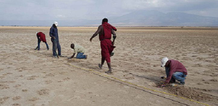
Local Maasai staff lay out the geophones, a crucial piece of equipment in seismic imaging of the Olduvai Basin.
© 2017 Sherif Hanafy
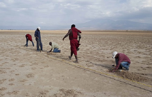
The seismic field crew working in Olduvai Gorge, including Sherif Hanafy (blue shirt, fourth from right) and Kai Lu (red shirt, second from right).
© 2017 Sherif Hanafy
In the peaceful grasslands of northern Tanzania, a frenzy of research is occurring. The Olduvai area (from the Maasai name “Oldupai” for a native succulent plant) came to fame through the findings of Kenyan archaeologists and paleoanthropologists Louis and Mary Leakey. Their research, beginning in the 1950s, uncovered numerous fossil hominins (the tribe of great apes, including modern humans) and stone tools dating back as far as two million years and earned the area the nickname “cradle of humankind.” Olduvai has since become a hub for those exploring the origins, and future, of humanity.
Paleoanthropologists, however, no longer have sole claim here. A full picture of human evolution cannot be gleaned from fossils alone, but relies on understanding their environmental context.
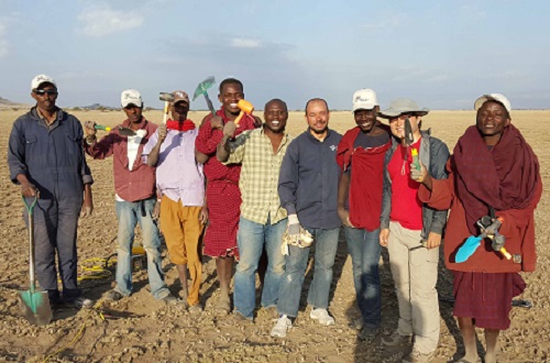
To this end, a team of KAUST’s geophysicists are conducting crucial surveys of the site’s geology. Using state-of-the-art techniques developed for oil exploration, Gerard Schuster, Sherif Hanafy and doctoral student Kai Lu, with scientists from Indiana University, USA, and Liverpool University, UK, are mapping the shape and structure of the Olduvai Basin’s bedrock.
This is no mean feat because the basin is six kilometers wide and almost half a kilometer deep. It comprises a complex mixture of sedimentary and volcanic rocks, traversed by multiple geological faults. Lying at the heart of the East African Rift Zone, where the tectonic plates making up the Earth’s crust are moving apart, Schuster explains that the basin, “evolved and deepened over time as the ancient lake above it expanded, contracted and shifted laterally in space, partly caused by a sequence of eruptions of neighboring volcanoes.”
Rewriting history
Two complementary experimental approaches are used: boring wells to extract physical cores of sediment laid down over millions of years and the KAUST team’s seismic imaging studies. Together, they are rewriting the geological history of Olduvai.
The seismic experiments are based on a remarkably simple premise: a heavy weight is repeatedly slammed onto the ground, creating vibrations that travel through it until they are reflected or refracted (bent) as they move from one material to another (in the same way that light reflects off a mirror or bends as it enters water). A series of receivers (known as geophones) are placed just below the ground to monitor these reflected and refracted waves. By recording the time taken for the waves to reach each of the geophones, the team can calculate the speed at which they traveled. In a similar way to ultrasound scanning, these measurements are built into a picture of the subsurface geology, including the basin’s shape and size and the location of buried faultlines.
Complex and logistically challenging, the method is intriguing to local people, many of whom are employed on the project. As Hanafy explains, “they are used to working with paleoanthropologists and geologists, but this is the first time they have worked with geophysicists.” The project has inspired some youngsters to develop a potentially life-changing interest in science—with one even traveling to KAUST to study.
The results of this research suggest that the Olduvai Basin, once considered shallow, is more than 400 meters deep, almost twice as deep as the boreholes were able to penetrate. This indicates that the bedrock lining the basin may be around 4 million years old and that environments suitable for hominins may be equally ancient: “much older,” says Hanafy, “than previously extrapolated from exposed rocky outcrops.” The base layers of the basin were probably derived from nearby volcanoes, which may have influenced the environment, including water availability, in the distant past. This in turn would have impacted upon early hominids, who needed “water, a favorable climate, trees for protection and open plains for foraging, all of which were provided at Olduvai,” explains Hanafy.
A new documentary
In Lasting Marks, a celebrated documentary about this work, the University of Liverpool’s Ian Stanistreet argues that seismic imaging helps us understand the entire makeup of Olduvai: geological, climatic and otherwise. The changing climate has proven a challenge to mankind throughout our history: if we can better appreciate this history, we may be moved to alter our trajectory. As the director of Lasting Marks, Sarah Schuster-Johnson, eloquently explains, “the dedicated and passionate Olduvai researchers carefully interpret marks from an undeciphered history, a history that paved the way for our existence and our future on this planet.”
References
ABOUT THE AUTHOR
Gerard Schuster
Professor

You might also like
Earth Science and Engineering
Carbon sequestration for arid regions overcomes water constraints
Earth Science and Engineering
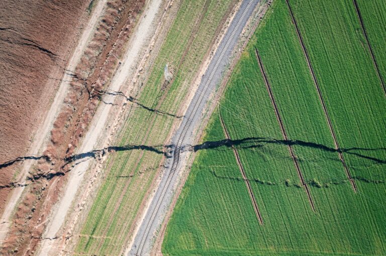
Asymmetric surface deformations reveal ongoing processes after earthquakes

Earth Science and Engineering
Depleted oil fields offer hydrogen storage sites
Earth Science and Engineering
When Earth breaks the “rules”
Earth Science and Engineering
Unearthing Arabia’s ancient foundations: New insights from the Ha’il terrane
Earth Science and Engineering
Sensing color cues to monitor coral health in the Red Sea
Earth Science and Engineering
Kahramanmaraş earthquake study showcases potential slip rate errors
Chemical Engineering