Earth Science and Engineering
Assessing the potential of major earthquakes near NEOM
Saudi Arabia might not be shaken from its ambitious development goals, but it cannot rule out large earthquakes entirely.


The potential for major earthquakes around the southern end of the Gulf of Aqaba may be lower than geophysicists feared. Separate studies by two students, using quite different approaches but arriving at similar findings, give hope that only infrequent large earthquakes will threaten emerging cities on the nearby shores of the Red Sea.
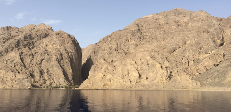
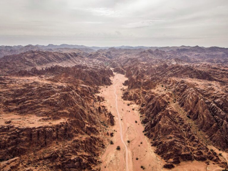
The Dead Sea Transform fault spans roughly 1200 kilometers from the Red Sea north to Turkey, and written records show it has produced many devastating earthquakes over the last 2,000 years. However, there has been little study of seismicity in the sparsely populated region around the southern part of the fault, where the Gulf of Aqaba meets the Red Sea.
“This area is now of great interest to Saudi Arabia because they are building the future megacity of NEOM very close to the Gulf of Aqaba,” says geophysicist Sigurjón Jónsson from KAUST. “They also want to build the King Salman road crossing across the Gulf to Sharm El Sheikh.” In 1995, a 7.2 magnitude quake struck the northern Gulf. The impact of an earthquake of such magnitude beneath the proposed crossing would be disastrous, so it is essential that engineers understand the seismic hazard in the region.
The Arabian side of the fault has been moving steadily northwards at around five millimeters per year.
Xing Li and Nicolás Castro-Perdomo, Jónsson’s research students, led separate studies of plate motion around the Gulf of Aqaba. Both students used satellite geodesy, a universal framework for measuring the precise location of points on Earth. By observing how reference points on the surface move over time, geophysicists can study the deformation of tectonic plates and observe how rapidly stress and strain is building around fault lines. “Estimating how fast elastic energy builds up gives us crucial information on how frequently, and how large, earthquakes might be,” says Perdomo.
Perdomo used a network of more than 40 global positioning system (GPS) stations on the ground around the Gulf and modeled the tectonic deformation from their positions in 2015, 2017 and 2019.
Conversely, Xing Li used Interferometric Synthetic Aperture Radar (InSAR) imagery, produced by satellites bouncing radar signals off the Earth’s surface, to measure plate motion. However, InSAR imagery from polar-orbiting satellites does not capture north-south motion. “By focusing on areas where the satellite images overlap, where common signals cancel out, we could retrieve the north-south displacement,” explains Li. She used more than 300 satellite images collected between 2014 and 2020 to create multiple 160-kilometer-long profiles of plate motion around the Gulf.
Both studies found the Arabian side of the fault has been moving steadily northwards at around five millimeters per year. However, they noted a greater near-fault velocity to the south of the Gulf, which they attribute to the Earth’s crust thinning, thereby creating less friction towards the Red Sea. Perdomo used existing models of crustal deformation to interpret their observations. “The rapid near-fault velocity gradient implies that the southernmost fault could be steadily sliding along without producing major earthquakes,” he says.
Both methods have proven reliable, yet GPS surveys remain labor intensive and expensive. “We’ve found an efficient and low-cost way to gather vast quantities of data that enable us to calculate even very slow horizontal displacement along a north-south fault, without doing any fieldwork,” says Li.
“There is uncertainty within each method, and lots of assumptions had to be made,” says Jónsson. “But the fact that both studies independently concluded that earthquake hazard decreases towards the southern end of the Gulf strengthens the results tremendously.” And a recent analysis of sedimentary cores collected from the bottom of the Gulf also suggests that large quakes have historically been less frequent at its southern end. “While this is good news, NEOM is not off the hook,” says Jónsson, “More investigations into local site conditions, as well as earthquake simulations, are needed to guide the construction of a resilient city.”
References
- Castro-Perdomo, N., Viltres, R., Masson, F., Klinger, Y., Liu, S. Dhahry, M., Ulrich, P., Bernard, J.-D., Matrau, R., Alothman, A., Zahran, H, Reilinger, R., Mai, P.M. & Jónsson, S.. Interseismic deformation in the Gulf of Aqaba from GPS measurements. Geophysical Journal International 228, 477–492 (2021).| article
-
Li, X., Jónsson, S. & Cao, Y. Interseismic deformation from Sentinel-1 burst-overlap interferometry: application to the Southern Dead Sea Fault. Geophysical Research Letters 48, e2021GL093481 (2021).| article
ABOUT THE AUTHOR
Xing Li & Nicolás Castro-Perdomo
Ph.D. Student & Alum

You might also like
Earth Science and Engineering
Carbon sequestration for arid regions overcomes water constraints
Earth Science and Engineering
Asymmetric surface deformations reveal ongoing processes after earthquakes

Earth Science and Engineering
Depleted oil fields offer hydrogen storage sites
Earth Science and Engineering
When Earth breaks the “rules”
Earth Science and Engineering
Unearthing Arabia’s ancient foundations: New insights from the Ha’il terrane
Earth Science and Engineering
Sensing color cues to monitor coral health in the Red Sea
Earth Science and Engineering
Kahramanmaraş earthquake study showcases potential slip rate errors
Chemical Engineering