Applied Mathematics and Computational Sciences | Earth Science and Engineering | Energy Resources and Petroleum Engineering | Marine Science | Statistics
Data-driven regional ocean models essential for planning
A data-driven modeling system that reconstructs oceanic circulation of the Red Sea highlights the importance of developing region-specific historical datasets.

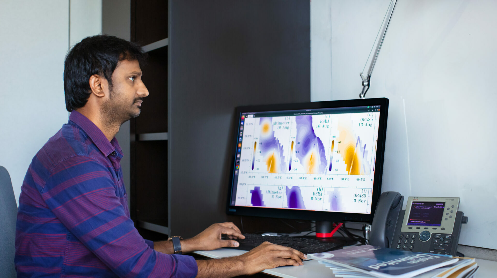
By incorporating fine-grained regional data with a high-resolution ocean model, KAUST researchers have developed the first precise historical reconstruction of the Red Sea circulation.[1] The resulting reanalysis reveals new characteristics of current circulation, temperature, salinity and oceanic behavior that are not evident in the coarser standard global ocean analyses.
“Currently, industry and scientists rely on global ocean datasets that do not resolve the characteristics of the regional seas,” says climatologist Ibrahim Hoteit, who led the research team. “This can carry significant financial and scientific implications.”
Existing global ocean models use coarse modeling grids and are tuned to describe global circulations, and so are unable to generate accurate analyses of ocean phenomenon at smaller regional scales. One key reason for this is the enormous amount of computation required for even coarse global models, which makes it difficult to increase their resolution.
Therefore, to utilize local and regional data effectively, and still be computationally feasible, it is necessary to perform a reanalysis on a smaller regional scale with a finer grid size. This is a challenge for the Red Sea region due to limited data availability.
“The Red Sea generally lacks long-term datasets, which exacerbates the challenges in understanding and predicting the specific climatic patterns and dynamics in this region,” says Sivareddy Sanikommu, from the research team.
To compile the regional dataset, the research team integrated all available satellite and in situ ocean data, incorporating improved bathymetry, employing a high-resolution spatial grid and an in-house regional high-resolution atmosphere. Subsequently, they fine-tuned their ocean model parameters to accurately depict the Red Sea physics through a process of extensive sensitivity experiments.
“We developed a computationally efficient ensemble approach combining current and historical scenarios and using the state-of-the-art computational capabilities of KAUST’s Shaheen supercomputer,” Sanikommu says. “This meant we were able to account for uncertainties in various inputs and manage the computational demands to perform the large-scale simulations needed for this study,”
The new Red Sea reanalysis resolved a three-layer transport current through the Bab-al-Mandab Strait in summer — a feature simulated in global models as two-layer transport — and reproduced seasonal anomalies, interannual variations in salinity, and temperature and sea level trends more accurately than global models.
“Our study represents a caution on the use of global models for decision-making, particularly around megadevelopments such as those underway in Saudi Arabia. This demonstrates through the example of the Red Sea the importance of generating accurate regional models and datasets using local data,” says Hoteit.
Reference
- Sanikommu, S., Langodan, S., Dasari, H. P., Zhan, P., Krokos, G., Abualnaja, Y. O., Asfahani, K. & Hoteit, I. Making the case for high-resolution regional ocean reanalyses: An example with the Red Sea. Bulletin of the American Meteorological Society 104, E1241–E1264 (2023).| article
You might also like

Applied Mathematics and Computational Sciences
Smarter MRI image analysis for the whole heart

Marine Science
Potential gains from replenishing reef fish stocks revealed

Earth Science and Engineering
When Earth breaks the “rules”

Applied Mathematics and Computational Sciences
Realistic scenario planning for solar power

Statistics
Checking your assumptions

Earth Science and Engineering
Unearthing Arabia’s ancient foundations: New insights from the Ha’il terrane

Statistics
Internet searches offer early warnings of disease outbreaks

Marine Science


