Earth Science and Engineering
Tsunami: The importance of underwater landslides
An underwater landslide triggered by the 2011 earthquake in Japan may have exacerbated the resulting tsunami.
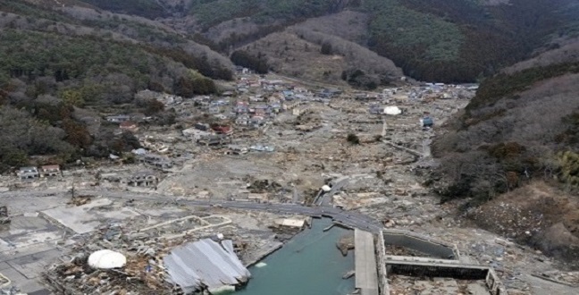
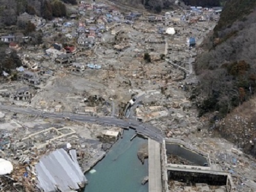
An international team of researchers including scientists at KAUST have been modeling the tsunami triggered by the 2011 Tohoku earthquake in Japan.
© Thinkstock
Four years after the devastating Tohoku earthquake on Japan’s Eastern seaboard in March 2011, scientists are still deciphering the exact cause of the extraordinary tsunami that followed. Researchers at KAUST show unequivocally the importance of secondary effects such as underwater landslides.
Following the magnitude 9.0 earthquake the Sanriku region on Honshu Island was struck by waves measuring 40 m high — four times the height of the tsunami in other areas. Thousands of people lost their lives, yet no models using earthquake-only data have been able to recreate these wave patterns.
Now, an international team of scientists from Japan, the UK, and the USA, together with Martin Mai and Kiran Thingbaijam from KAUST’s Division of Physical Science and Engineering, have produced a series of prediction models with the hypothesis that an enormous submarine landslide, triggered by the earthquake, caused the localized heightened tsunami waves1.
“There has been great difficulty modeling and understanding the tsunami effects seen at Sanriku,” describes Mai. “One possible cause is a submarine landslide, triggered by horizontal shear-wave motions radiated by the earthquake rupture process. This has not been considered before for this earthquake, and is rarely included in detailed tsunami studies.”
The team faced opposition to the suggestion that the tsunami could have been exacerbated by a landslide originating from the Japan Trench — part of the subduction zone which lies off Japan’s coast. They had to prove that earthquake-only ocean floor ruptures were insufficient to trigger the extreme tsunami effects in Sanriku. The researchers conducted advanced numerical modeling to recreate the wave patterns, and statistical analysis of previously published earthquake models for that day.
“Nearshore buoys along the Sanriku coast recorded the travel times of higher-frequency tsunami waves,” explains Mai. “This data helped us build a picture of ocean floor movements that would trigger waves of that particular height, speed and wavelength.” The detail in the data also allowed the team to work backwards and pinpoint the likely source.
Comparisons of pre- and post-tsunami sea-floor surveys at the predicted location, 60 km north-east of the earthquake epicenter, revealed that a 2 km thick sediment slab had slipped 300 m down the Japan Trench. The model suggests that the landslide, which had an estimated volume of 500 km3, occurred around two minutes after the earthquake.
“Slope stability analysis confirmed the earthquake was sufficient to trigger a sizable landslide there,” states Mai. “This study shows the absolute necessity to include secondary effects, such as landslides, into future earthquake hazard studies and prediction models.”
References
-
Tappin, D.R., Grilli, S.T., Harris, J.C., Geller, R.J., Masterlark, T., Kirby, J.T., Shi, F., Ma, G., Thingbaijam, K.K.S. & Mai. P. M. Did a submarine landslide contribute to the 2011 Tohoku tsunami? Marine Geology 357, (2014).| article
You might also like
Earth Science and Engineering
When Earth breaks the “rules”
Earth Science and Engineering
Unearthing Arabia’s ancient foundations: New insights from the Ha’il terrane

Earth Science and Engineering
Sensing color cues to monitor coral health in the Red Sea
Earth Science and Engineering
Kahramanmaraş earthquake study showcases potential slip rate errors
Chemical Engineering
Unveiling the role of biomass-burning aerosols in atmospheric reactions

Earth Science and Engineering
Feeling the heat across the Middle East
Applied Mathematics and Computational Sciences
Past and future drought patterns across the Arabian Peninsula
Earth Science and Engineering


