Earth Science and Engineering
Acoustic waves give a bounce to real-time seismic imaging
Geologic structures and deposits below planetary surfaces can be mapped faster than ever.


A remote-sensing technique that can detect real-time changes in subsurface environments has undergone successful testing in the desert just outside the KAUST campus in Thuwal, Saudi Arabia.
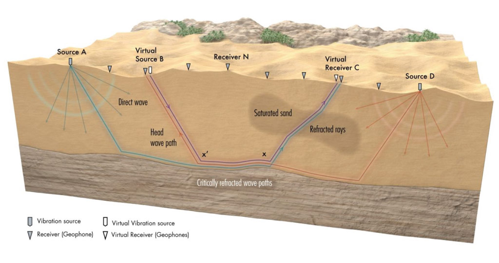
To avoid the time-consuming and destructive impact of drilling, geologists are increasingly turning to an approach known as seismic imaging. This procedure uses sonic sources at many different locations to send acoustic waves deep underground and then measures how long it takes for the waves to return to receivers on the surface. The travel time of the waves depends on properties such as the hardness or porosity of materials they pass through, and so this method can easily identify unique subsurface features, such as pockets of water.
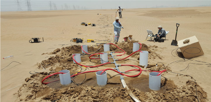
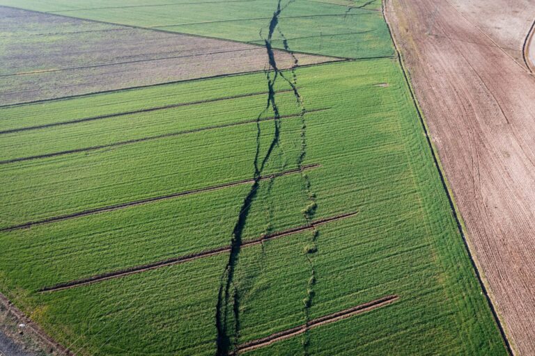
An array of audio sources and receivers were placed above a dry sand dune and 12 tons of water were injected into the dune to map the flow of the water below the surface.
© 2021, Hanafy et al. Illustration by Xavier Pita.
However, conventional seismic imaging is still too slow to detect real-time geologic events, notes KAUST geophysicist Gerard Schuster. “For a conventional seismic experiment, you need many different angular views to accurately estimate the properties of each substructure, which demands many hours to deploy and excite seismic sources over hundreds of different locations,” he says.
For the past 20 years, Schuster has been working on a solution to this issue by focusing on how the cyclical patterns of acoustic waves begin to lag or lead each other after passing through an underground material. These changes, known as phase differences, can be inverted by seismic interferometry to provide high-resolution structural information while requiring far fewer audio sources.
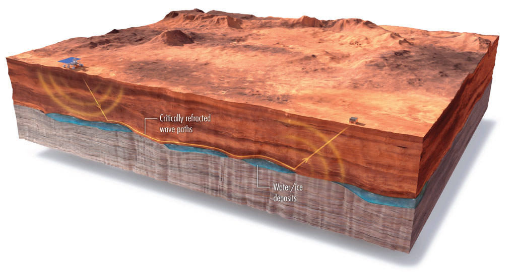
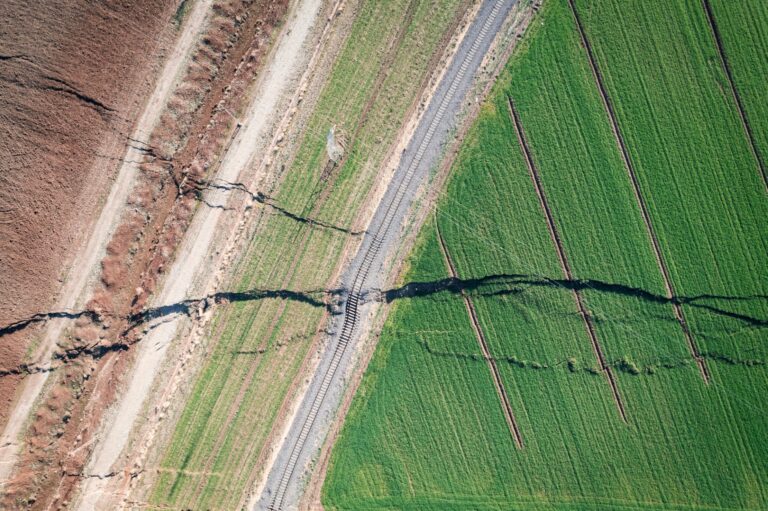
The simulations performed by the team could be applied to leaky damns or even seismic surveys on Mars or the moon.
© 2021, Hanafy et al. Illustration by Xavier Pita.
“This approach requires much less effort,” says Shuster. “Taking the time differences between the phases allows you to answer questions about the hardness and softness of geology with just a few experiments instead of hundreds.”
In their latest work, Schuster and colleagues performed a controlled time-lapse experiment to validate the capabilities of their seismic interferometry technology. First, the team set up an array of audio sources and receivers over a dry sand dune. Then, they injected 12 tons of water into the dune over a few hours while recording nearly one hundred interferometric measurements for each source location. This data was transformed every two minutes into snapshots of subsurface water flow as it percolated through substructural layers several meters under the surface.
“Our three-dimensional simulations of the experiments convinced us that what we saw wasn’t a false reading,” says Schuster. “The initial impact of these findings can be useful for environmental engineers who require rapid and inexpensive monitoring of the subsurface — for example, real-time imaging of leaky dams, or efficient Martian or lunar seismic surveys.”
References
- Hanafy, S.M., Hoteit, H., Li, J. & Schuster, G.T. Near‑surface real‑time seismic imaging using parsimonious interferometry. Scientific Reports 11, 7194 (2021).| article
ABOUT THE AUTHOR
Gerard Schuster
Professor

You might also like
Earth Science and Engineering
Carbon sequestration for arid regions overcomes water constraints
Earth Science and Engineering
Asymmetric surface deformations reveal ongoing processes after earthquakes

Earth Science and Engineering
Depleted oil fields offer hydrogen storage sites
Earth Science and Engineering
When Earth breaks the “rules”

Earth Science and Engineering
Unearthing Arabia’s ancient foundations: New insights from the Ha’il terrane
Earth Science and Engineering
Sensing color cues to monitor coral health in the Red Sea
Earth Science and Engineering
Kahramanmaraş earthquake study showcases potential slip rate errors
Chemical Engineering