Environmental Science and Engineering
A drone on crop resources
Aerial imaging of plant heights could help farmers manage field crops more effectively to increase yields and preserve resources.
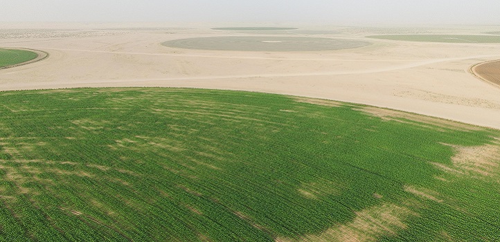
Monitoring the growth patterns of crop plants provides farmers with a strong indication of potential yield, allowing them to tweak crop management to boost production. Now, KAUST researchers have demonstrated that using fixed-wing unmanned aerial vehicles (UAVs) to collect data on vegetation height throughout the crop growth cycle provides a low-cost, simple way of monitoring plant health on a farm-wide scale.
“Farmers routinely have problems identifying areas in their fields that need attention: they cannot see what is happening in a field of 2-meter-high corn that is 800 meters in diameter,” says KAUST Ph.D. student Matteo Ziliani, who worked on the project with colleagues under the supervision of Matthew McCabe.
“Consequently, farmers often uniformly fertilize and water fields, regardless of which areas need more or less water. UAVs could help achieve effective precision agriculture, saving money and resources and growing better quality crops.”
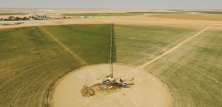
Farmers commonly apply a large amount of water to irrigate their crops, and they do this uniformly over the entire field regardless of individual plants’ health. The image above shows a typical irrigation boom that heavily waters a 50-hectare field.
© 2019 HALO Lab KAUST
Ziliani set out to show that the imaging data collected by UAVs is as useful as data retrieved by more expensive LiDAR laser scanning. To do this, the team took multiple images of the same 50-hectare maize field at different points throughout the growing season—one set of color images taken by UAV and the other by ground-based LiDAR. The researchers used each image set to build three-dimensional canopy models and to compare how closely the UAV images replicated the accurate LiDAR data.
“We can create three-dimensional models of objects using sets of two-dimensional images taken from different angles in the same way as the human brain processes our binocular vision,” says Ziliani.
The digital field maps generated using UAV data provided an accurate representation of crop height over time, comparable to those created using LiDAR. Ziliani acknowledges that further work is needed, for example, the computational power required to process the data is currently too large to be processed by an average desktop computer.
Also, when the plants were very young, the UAV struggled to pick up their structural details. This could be resolved by flying at lower levels, but this limits the area covered in the available flight time, which is in turn linked to battery life. Indeed, battery life will need to be improved if UAV technology is to meet its potential in monitoring crops across larger regions, searching for pockets of productive and unproductive land, or examining storm damage.

UAVs can help farmers to detect problems in the field at critical stages of the season. The image shows three subareas in the maize field and their development during the growing cycle. This includes: a healthy region (Area 1), a static bare-soil region (Area 2) and an affected region (Area 3).
Reproduced with permission from reference one under a Creative Commons License © 2018 Ziliani et al.
References
-
Ziliani, M.G., Parkes, S.D., Hoteit, I. & McCabe, M.F. Intra-season crop height variability at commercial farm scales using a fixed-wing UAV. Remote Sensing 10 2007 (2018).| article
You might also like

Environmental Science and Engineering
Bacteria reveal hidden powers of electricity transfer
Environmental Science and Engineering
Wastewater surveillance tracks spread of antibiotic resistance

Bioscience
Super fungi survive extreme Mars-like environments
Environmental Science and Engineering
Rethinking food systems to restore degraded lands
Environmental Science and Engineering
Combat climate change by eliminating easy targets

Environmental Science and Engineering
Wastewater treatment to fight the spread of antibiotic resistance
Bioscience
Digging into the world of plant-growth-promoting microbes

Bioscience


