Statistics
Shaking up the landslide model
Areas without earthquake monitoring systems could model the tremors by using data from local landslides.


Landslides could be used to map earthquake tremors when seismic sensors do not cover the ground.
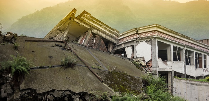
Earthquakes in mountainous terrain can trigger landslides that are as damaging as the tremors themselves. In 2008, a major quake in Wenchuan, China, caused nearly 200,000 landslides. These landslides resulted in a third of around 69,000 deaths reported during the earthquake event. Pinpointing the areas at greatest risk of slides during or after an earthquake would help reduce the impacts of these disasters.
A growing network of motion sensors records seismic activity around the globe although some hazard zones are less well covered. Statistical models can help predict whether an earthquake could trigger a landslide in a certain region, but this uncertain approach misses some important details for risk assessments, such as the number and size of potential landslides.
In 2018, Luigi Lombardo and his cosupervisors, Raphaël Huser and Martin Mai, at KAUST proposed a way to retrieve missing information on a landslide trigger—the rainfall pattern during a storm—but without direct measurements, they could not verify their theory. However, the vast quantity of free seismic data provided the perfect opportunity to test such a model on earthquake-triggered landslides.
The KAUST team collaborated with researchers at the University of Twente, Netherlands, to examine landslide inventories from two major earthquakes that struck east of the Tibetan Plateau: the Wenchuan quake and the Lushan quake of 2013, which triggered more than 15,500 landslides.
The researchers modeled the landslide zones using variables that could influence landslide occurrence, including elevation, steepness, curvature and orientation of slopes, underlying geology, land cover and average climate. “I wanted to show that it is possible to get information on a missing landslide “trigger”—in this case, the seismic shaking,” says Lombardo.
Such hefty data processing, however, meant that one run of the model could last many hours to several weeks. So they focussed on two smaller areas at high and medium resolutions and tested whether their model could map ground motion patterns from the landslide distributions. The results were very promising. “We were able to capture the unknown seismic-shaking signature of the Wenchuan and Lushan earthquakes with high accuracy,” confirms Huser.
“We have created an extremely powerful tool to explain what happened in the past,” says Lombardo, “but it needs to be refined to be able to predict future events because the next earthquake, or storm, will be different. We would also like to see whether past landslides increase or reduce the risk of future slides.”
The ultimate goal for Lombardo is to predict not only where, when and how many landslides might occur, but also their size. “Governments often work on a restricted budget. Knowing whether one slope is more vulnerable than another will help them prioritize protecting areas at greatest risk.”
References
- Lombardo, L., Bakka, H., Tanyas, H., van Westen, C., Martin Mai, P. & Huser, R. Geostatistical modeling to capture seismic-shaking patterns from earthquake-induced landslides. Journal of Geophysical Research: Earth Surface 124, 1958 – 1980 (2019).| article
ABOUT THE AUTHOR
Luigi Lombardo
Alum

You might also like

Statistics
Checking your assumptions

Statistics
Internet searches offer early warnings of disease outbreaks

Statistics
Joining the dots for better health surveillance

Statistics
Easing the generation and storage of climate data

Statistics
A high-resolution boost for global climate modeling

Applied Mathematics and Computational Sciences
Finer forecasting to improve public health planning

Bioengineering
Shuffling the deck for privacy

Bioengineering