Environmental Science and Engineering
New eyes in the skies
The availability of high-resolution data collected by miniaturized satellites heralds a turning point in Earth and environmental sensing from space.


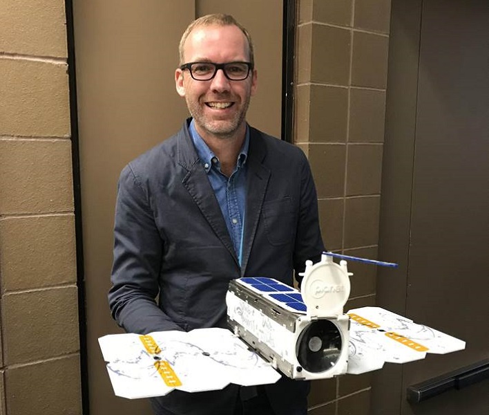
The advent of small, specialized satellites called CubeSats are transforming our ability to monitor the Earth’s surface and the impact of human activity on the planet. Scientists at KAUST are pioneering research techniques based on CubeSat data and are excited about the potential of these satellites, particularly for the fields of hydrology and precision agriculture.
Traditional satellite data used for research, collected predominantly by government space agencies, presents certain limitations. Generally, either the data provides high spatial resolutions occasionally—detailed images taken every two weeks—or the data provides low spatial resolution frequently. In the latter scenario, significant details can be missed. CubeSats are changing this paradigm, collecting meter-scale spatial detail over Earth’s terrestrial surfaces every day.
“I certainly didn’t expect these constraints to be lifted any time soon,” says hydrologist and remote-sensing specialist, Matthew McCabe, of KAUST. “Normally, satellite design takes years—researching and developing sensors, negotiating with a government space agency and funding bodies—before possibly seeing your mission chosen for launch. Then, there’s the chance that something could go wrong upon launch or deployment or that you simply don’t get the data you need.”
Recent advances in CubeSat technology could change this. These shoebox-sized satellites are comparatively cheap to make and launch: they are built from off-the-shelf components and sensors and sent into orbit either as companion payload or on small, reusable rockets. Once launched, CubeSats orbit the Earth at heights of 350 to 500 kilometers for a period of a few weeks to more than a year, relaying data to Earth (before ultimately burning upon re-entry into the atmosphere).
The great advantage of their small size and cost means that “constellations” of CubeSats can be launched, setting up a conveyor belt of satellites capturing multiple high-resolution images at high temporal repeat rates.
“This kind of high-resolution repeatability from space has never been available before,” says McCabe. “It has the potential to transform fields, such as disaster management and response by monitoring and directing relief efforts, or to track environmental change by identifying illegal deforestation in the Amazon, for example. If we can observe and identify problems before, or as they arise, we can take action to address them.”
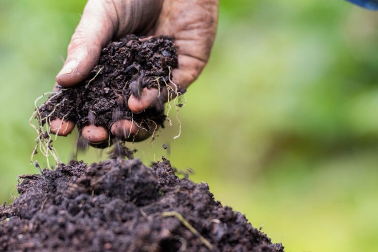
McCabe’s team recently launched a project in line with the Saudi Arabian government’s Vision 2030 that uses data from CubeSats and other satellites to help monitor water and food security issues. With agriculture using vast quantities of the Kingdom’s limited freshwater supplies, the team will use these satellite data to monitor crop health and irrigation rates to build up a clear picture of the country’s water use. This work will help guide future policies in water security.
Similarly, the status of global food security could be analyzed using data from CubeSats. As McCabe’s team recently demonstrated, it is now possible to retrieve high-quality imagery of individual fields daily, down to a resolution of three meters. From these, machine learning techniques can assess the health and condition of individual crops using measurements, such as leaf-area index and transpiration rates. This will enable more accurate predictions of potential yields and can verify when and where problems start, allowing farmers to take appropriate action.
“CubeSat technology also allows us to interrogate data to find out which crops are being grown where,” adds McCabe. “In African countries, for example, there are few records showing what each farmer grows on their small piece of land. This information could pass into globally relevant databases to help tackle food security issues by tracking supply.”
CubeSats are largely being built and launched by commercial companies at present, although space agencies, such as NASA and ESA, are also funding some CubeSat and nano-sat initiatives.
“I’ve developed a strong collaboration with a CubeSat company called Planet,” says McCabe (www.planet.com). “Data from their CubeSat missions are available to scientists in all different fields for analysis—it’s an incredible resource. Although most CubeSats don’t carry expensive, research-grade components, meaning calibration can be a problem, we’re working on a range of innovative machine learning and modeling techniques that provide research quality data for Earth observation.”
McCabe sees the potential of CubeSats in providing new insights across environmental sciences but also in providing a platform for the demonstration of novel sensors and technologies in space. By harnessing these emerging systems, strategies that address some of the major global challenges in food, water and environment could soon be implemented.
References
-
McCabe, M.F., Aragon, B., Houborg, R. & Mascaro, J. CubeSats in hydrology: Ultrahigh-resolution insights into vegetation dynamics and terrestrial evaporation. Water Resources Research 53, 10017–10024 (2017).| article
ABOUT THE AUTHOR
Water Desalination and Reuse Center

You might also like
Environmental Science and Engineering
Soil biodiversity is an overlooked frontline of disease prevention

Environmental Science and Engineering
Soil microbes are source of plastic-degrading enzymes

Environmental Science and Engineering
Bringing together the tools to harness the potential of microbial diversity

Environmental Science and Engineering
Climate action needs a tree change

Chemical Engineering
Natural solvents enable fully bio-based membranes

Environmental Science and Engineering
Plant diversity reduces the impacts of grazing pressure in drylands

Environmental Science and Engineering
Water-repelling surfaces reveal surprising charging effects
Environmental Science and Engineering