Environmental Science and Engineering
A blossoming field of precision agriculture
KAUST researchers are working to find new ways of monitoring irrigation, crop health and yields.


KAUST researchers work to find ways of monitoring irrigation to help farmers produce good quality high crop yields.
© 2016 KAUST
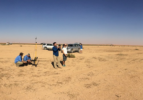
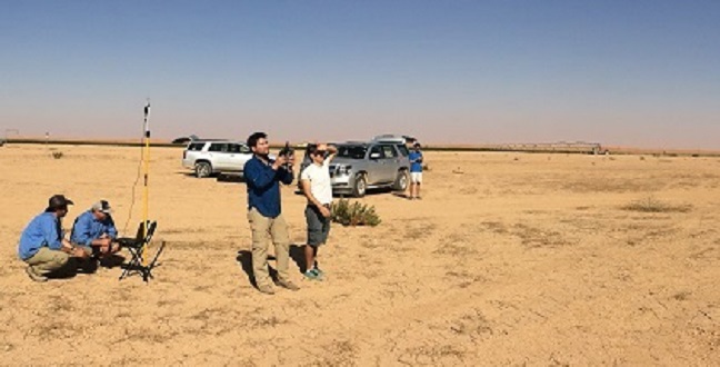
McCabe and his team use cameras mounted on unmanned aerial vehicles to monitor crop health and water use in agriculture.
© 2016 KAUST
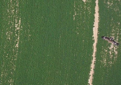
A steppe eagle in flight over crops was photographed by an unmanned aerial vehicle from above the fields during trials by McCabe’s team in Saudi Arabia.
© 2016 KAUST
New methods of monitoring irrigation, crop health and yields are being pioneered by KAUST to generate and safeguard sustainable food supplies and to better manage global water resources.
On a global scale, agriculture accounts for around two-thirds of freshwater use, a figure that rises to 85 percent in arid regions such as in Saudi Arabia. However, the amount of water taken from groundwater aquifers, rivers and lakes to supply irrigation needs is rarely monitored, putting future food and water security under threat in the face of changing climate and population growth.
Matthew McCabe, an associate professor in the University’s Water Desalination and Reuse Center (WDRC), leads a research team undertaking groundbreaking research that monitors crop health and water use more closely than ever before through data collected by novel technologies like unmanned aerial vehicles (UAVs) and nano-satellites1.
“My group focuses on research related to hydrology, which is the understanding and quantification of the interactions of water with the landscape,” McCabe said. “We generally use water quite inefficiently, but this is especially true in agriculture. It is a problem that stems from poor irrigation techniques and uninformed crop management. Finding ways to improve this is critically important if we’re to achieve more sustainable use and management of global water resources.”
For farmers across the world, a key goal is to generate high-quality, abundant crops. To do this, farmers need accurate real-time information on crop health and productivity that ideally comes down to monitoring individual plants on a daily basis.
This information would enable them to make informed decisions about whether plants are receiving too little or too much water, whether they are suffering from disease and whether they are thriving in specific soils. The information can be gathered by monitoring factors such as biomass (the quantity or weight of a crop in a given area); leaf health and chlorophyll content (referring to pigments that make plants green); and transpiration (the water used by plants).
McCabe is excited by the potential of new high-resolution data collection techniques that could transform the blossoming field of precision agriculture.
“Trying to understand the fine-scale characterization of agricultural systems and optimize the inputs (water, fertilizer) to maximize the outputs is the basis of precision agriculture,” McCabe noted. “It is both an observation and a modeling problem. We can use satellites—and now UAVs—to tell us so much about the state of a crop. For example, we developed a collaboration with a Silicon Valley startup company called Planet that is launching hundreds of very small satellites to monitor the entire Earth’s surface on a 3 to 5 meter scale. This gives us access to high-resolution satellite data that can be used to provide incredible detail of the land surface.”
Rasmus Houborg, a researcher in McCabe’s Hydrology, Agriculture and Land Observation (HALO) group, recently developed a machine learning technique that can take information from the RGB (red-green-blue) color images collected by Planet’s nano-satellites and combine this information with other satellite data to create Normalized Difference Vegetation Index (NDVI) maps. NDVI is a tool that can be used to infer the amount of healthy green vegetation in a specific area and is a gauge of how well a crop is functioning. These new NDVI maps represent one of the highest resolution NDVI data sets available from space. Such revolutionary datasets have the potential to transform agriculture management on a global scale.
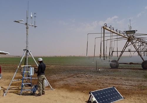
McCabe’s research group is also exploiting advances in UAVs to scan individual plants and fields. Recent trials in Saudi Arabia have proven successful through the use of UAVs programmed to fly systematically over crops while carrying sensors that gather data at centimeter-scales on features such as leaf chlorophyll content, temperature and even vegetation height, for example.
The KAUST team is working towards creating a decision support system that will provide farmers with fully autonomous and real-time reporting of crop health and productivity metrics.
“This data is of interest not just to farmers but also to government agencies that are responsible for water allocations (or resources), aid agencies looking to assess food production forecasts and even traders who hedge bets on global crop yield estimates,” McCabe said. “The scope and potential that such technologies have is amazing. We are witnessing an exciting revolution in Earth observation that will change the way we manage our food and water resources.”
References
-
Houborg, R. & McCabe, M. High-resolution NDVI from Planet’s Constellation of Earth observing nano-satellites: a new data source for precision agriculture. Remote Sensing 8, 768 (2016).| article
You might also like
Environmental Science and Engineering
Soil biodiversity is an overlooked frontline of disease prevention

Environmental Science and Engineering
Soil microbes are source of plastic-degrading enzymes

Environmental Science and Engineering
Bringing together the tools to harness the potential of microbial diversity
Environmental Science and Engineering
Climate action needs a tree change

Chemical Engineering
Natural solvents enable fully bio-based membranes

Environmental Science and Engineering
Plant diversity reduces the impacts of grazing pressure in drylands
Environmental Science and Engineering
Water-repelling surfaces reveal surprising charging effects
Environmental Science and Engineering